Disclaimer:
The authors are solely responsible for the content of this report. Material included herein does not represent the opinion of the European Community, and the European Community is not responsible for any use that might be made of it.
Back to overview measures
The study development can be described as iterative process with the involvement of a stakeholder group consisting of client (SUBV), water management, nature conservation and federal waterways administrations (NLWKN, WSV) as well as dyke and nature conservation associations (BUND Bremen).
The following development targets were defined for the potential project area:
Plantings are only intended on a small scale in order to promote spontaneous development. Initial plantings of softwood species in the north of the project area will be compared to an unplanted area to the south. The observation of both areas is expected to allow general conclusions on the effectiveness of initial plantings.
In order to protect the main dike of the river Weser, a line of willow plantings is used to catch flotsam. As a co-benefit, the decomposing flotsam promotes structure diversity in favor of insects and small animals.
The remaining area not affected by alteration and profiling activities is left to natural succession. Mowing or grazing is not foreseen.
The preferential scenario can be implemented in partial steps.
The sub scenario (Figure 4) comprises the removal of bank reinforcement and the installation of an additional overflow barrier.
The study ends with estimating the enhancement potential according to the guidelines on impact regulation after nature protection law for the federal state of Bremen. Even more crucial than this habitat related assessment is the expected functional benefit in view of adjacent Natura 2000 sites.
The study results are principally applicable to comparable projects in the fresh water zone of the Weser estuary and other estuaries of the North Sea region.
Back to top
Werderland
Table of content
- 1. Measure description
- 1a. Project description
- 1b. Monitoring
- 2. Execution of main effectiveness criteria
- 2a. Effectiveness according to development targets of measure
- 2b. Impact on ecosystem services
- 2c. Degree of synergistic effects and conflicts according to uses
- 3. Additional evaluation criteria in view of EU environmental law
- 3a. Degree of synergistic effects and conflicts according to WFD aims
- 3b. Degree of synergistic effects according to Natura 2000 aims
- 4. Crux of the matter
- 5. Literature
Additional information
for this measure:
No further information available.
for this measure:
No further information available.
Project description
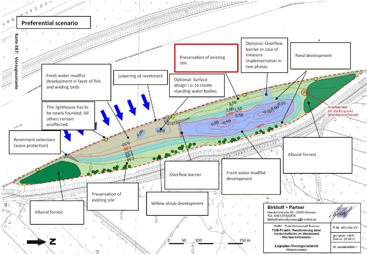
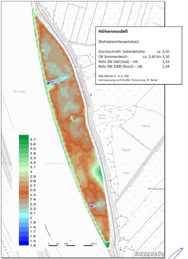
This pilot project realized in the frame of TIDE includes a feasibility study on the restoration of a dike foreland in Werderland (Bremen, Niederbüren). The foreland restoration is planned to be partly realized as a compensation measure after national environmental law for coming main dike reinforcements at Weser and Lesum (right bank). According to present knowledge, the expected compensation requirements due to the necessary reinforcement measures are not claiming the entire potential project area (Figure 2). In terms of sustainability and effective use of available resources and means, the study however aimed at developing an overall concept suitable to be realized in partial steps.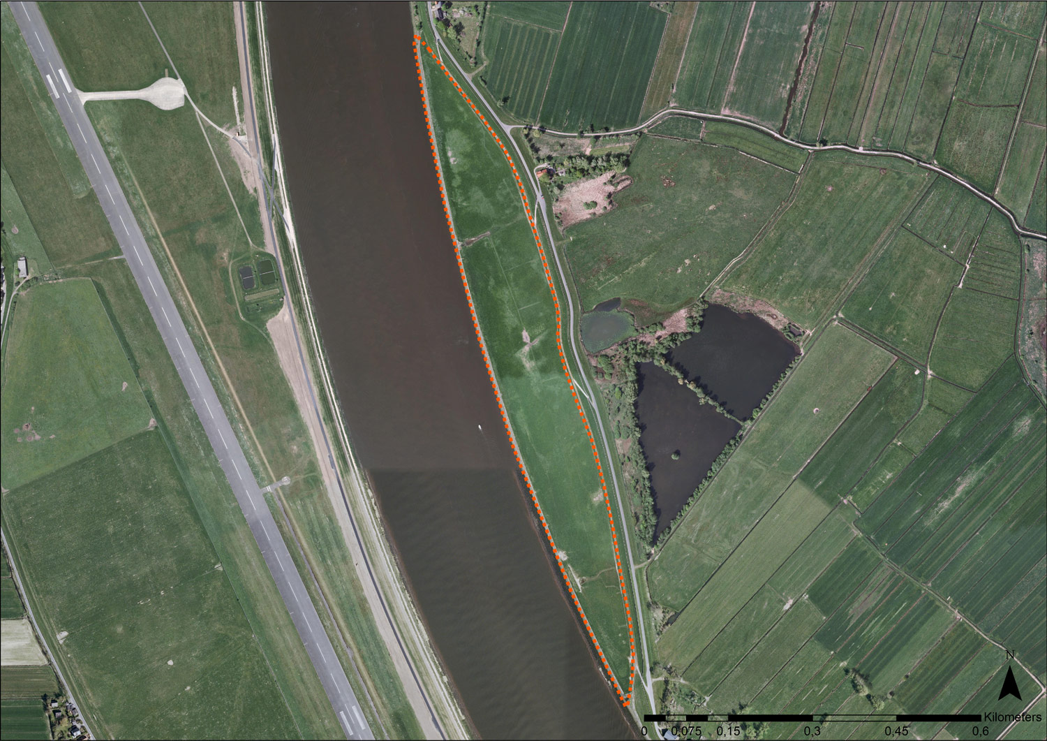
The study development can be described as iterative process with the involvement of a stakeholder group consisting of client (SUBV), water management, nature conservation and federal waterways administrations (NLWKN, WSV) as well as dyke and nature conservation associations (BUND Bremen).
The following development targets were defined for the potential project area:
- Functional development of tidal floodplains with focus on fish fauna (especially migrating species like Sea lamprey (Petromyzon marinus) and European river lamprey (Lampetra fluviatilis)
- Development of typical estuarine, tidally influenced foreland habitats (shallow water zones, flooding pools and fresh water mudflats, alluvial forests and reeds)
- Highest possible enhancement in terms of nature conservation according to guidelines on impact regulation after nature protection law for the federal state of Bremen (UNIVERSITÄT HANNOVER, INSTITUT FÜR LANDSCHAFTSPFLEGE UND NATURSCHUTZ 2011)
- Long term functionality with low maintenance effort
- Extent of shallow water zone
- Composition of water regime (contact period between shallow water zone on project area and river and height of overflow barriers)
- Percentages of aimed at habitats (shallow water zone, mudflats and reeds)
Plantings are only intended on a small scale in order to promote spontaneous development. Initial plantings of softwood species in the north of the project area will be compared to an unplanted area to the south. The observation of both areas is expected to allow general conclusions on the effectiveness of initial plantings.
In order to protect the main dike of the river Weser, a line of willow plantings is used to catch flotsam. As a co-benefit, the decomposing flotsam promotes structure diversity in favor of insects and small animals.
The remaining area not affected by alteration and profiling activities is left to natural succession. Mowing or grazing is not foreseen.
The preferential scenario can be implemented in partial steps.
The sub scenario (Figure 4) comprises the removal of bank reinforcement and the installation of an additional overflow barrier.
The study ends with estimating the enhancement potential according to the guidelines on impact regulation after nature protection law for the federal state of Bremen. Even more crucial than this habitat related assessment is the expected functional benefit in view of adjacent Natura 2000 sites.
The study results are principally applicable to comparable projects in the fresh water zone of the Weser estuary and other estuaries of the North Sea region.